First published: May 27, 2024 | Permalink | RSS

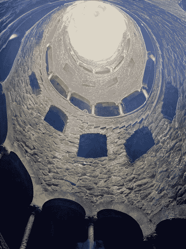
A dithered view from the bottom of the Initiation Well at Quinta de Regaleira in Portugal. The well is a large stone sprial staircase with ornate arches twisting up to the sunlight. Strongly recommend visiting if you can.
Recently returned from a ten day vacation in Lisbon, Portugal to celebrate my mother-in-law's birthday. This is the longest trip I've taken since Ruby and I spent three weeks in Ireland for our honeymoon in 2022. We stayed in a cute apartment with a garden and walking proximity to the city center. In and around Lisbon, we were able to walk and ride trains and busses to most of the places we wanted to visit and that was such a great way to get to know the city. Any time we took a cab or ride share, I would very quickly lose my sense of space.
We visited a few places like Sintra National Park, the Oceanarium and even some of the airports we flew through where having a physical map would have helped. Since my dumb phone only works in North America, I brought my iPhone I used to use with me to make sure I could communicate easily with my travel companions. So I had access to mobile map apps, but those maps do not often have the context needed to navigate from one airport terminal to another. Each of these places had some sort of "you are here"-style map that I could take a photo of and reference. But trying to pinch to zoom to find small features in a photo of a map taken through glass is a rough user experience to say the least.
The Quinta de Regaleira palace and ground had a QR code with a PDF map that was much clearer to use but still had the pinch to zoom issue of zooming in to see small things but losing the overall layout. What I really wanted in each of these circumstances, was a theme-park-style paper map that would give a sense of scale for the places and provide place-specific context for where to find restaurants, features, toilets, and transit routes. Near the Sintra train station one kiosk had these displayed but was closed so we couldn't grab one.
Great maps like these were regularly posted around on small billboards but were unavailable to carry. And yes, handing these out by default to every visitor to a place would create a lot of waste since not everyone is a map nerd like me who will frame and hang maps on their walls. But having these available to visitors by request or purchase would be a good compromise.
Having a paper map in a park or region really adds to the sense of exploration that many tourists and visitors want to experience. Of course, most places are set up with a plethora of wayfinding that means moving around is more navigating than exploring uncharted territory, but the place is new to that visitor so the feeling is still one of exploration. Filling out the map in their mind by connecting their understanding of the symbols on the map with the physical features in a new-to-the-visitor place is a satisfying experience.
The City of Philadelphia recently reprinted an updated bike infrastructure map that they stopped printing in 2015 or 2016, and having a new tangible map of the city felt so special and I was so excited to see it in my local bike shop. One of the owners knew I would be excited by it and set one aside for me. I have a strong mental map in my head of our bike lanes already (complete with my own (sometimes snarky) notes and updates), but having that map to look at, point to, mark on, and show guests is such a valuable asset.
Making a good map is hard, and like drawing anything else, the choices involved in what to include or omit are daunting and require expertise of the thing itself and the experience of viewing that map or drawing. What features, colors, icons, etc. will all also vary depending on who the map is for. The best map of a single place will be incredibly different for a tourist, a courier, or a telecommunications engineer.
Maybe its just because I use a dumb phone now, or maybe I have always been this nerd, but I really value having a paper map to walk around a place with to navigate and also as a tool to enhance my mental map. I'd like to make more maps for fun, especially something in the realm of the Philly Bookstore Map or theme park maps of neighborhoods. I would especially like to learn to design maps for print. I have experience designing maps for the web, but recently learned how much harder it is to design a static map since you can't click an icon on a paper map for more context. Do you know any good map design books?
Thank you for reading!